
Subsea excavation
Innovative solutions and technologies to support subsea excavation

At the forefront of innovation, our subsea services are designed to deliver reliable, efficient, and safe solutions across the energy sector.
With decades of experience and a commitment to excellence, we support clients in overcoming complex underwater challenges across the offshore energy lifecycle, from installation and maintenance to inspection and decommissioning.

Installation and commissioning
Offshore installations and components are thoroughly prepared onshore, while systems are tested at our yard to maximise execution and efficiency. Our tailored solutions range from riser, flexible and spool installations to sonar transponders, ICCP systems and snagging campaigns.
Inspection, repair and maintenance
Whether work is carried out from a vessel or at height, we always strive to mitigate conflicting activities such as simultaneous operations (SIMOPS), ensure short turnaround times, and prevent the temporary stopping of asset functionalities.
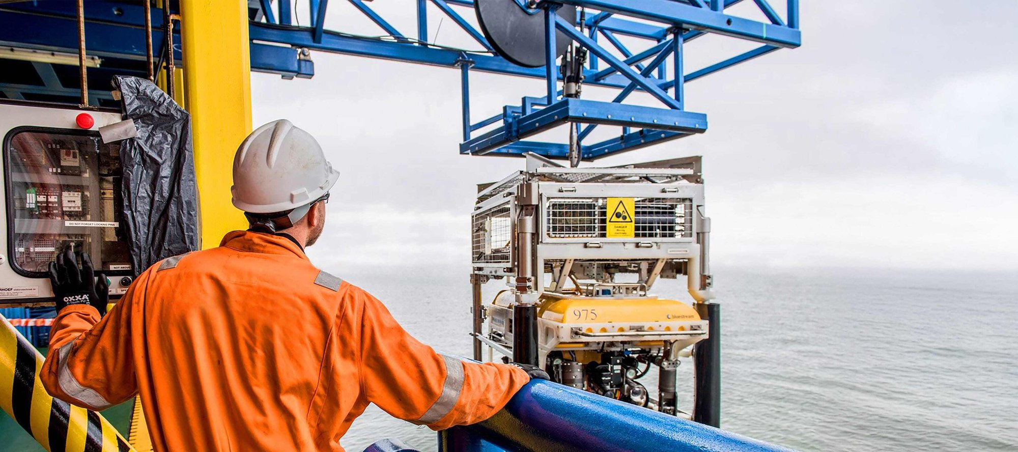
Rig support
We offer rig support services, including spudcan inspections and observation support, to a wide range of clients through our growing fleet of observation ROVs. These ROVs enable quick and efficient mobilisation whilst requiring minimal deck space.
Decommissioning

Our diverse fleet of chartered and owned vessels includes provision of specialist platforms to support a wide range of offshore and nearshore operations, including diving support services.
Featured Case Studies
Ideas and strategies behind some of our contract-winning solutions, supporting the offshore energy sector to transition to a sustainable future.

Our history in the subsea sector is rich combining decades of expertise. Below are the companies we have acquired over the years that now makes up our integrated Subsea services offering.
Our team of technical experts are here to support you.


%20(1200%20x%20675%20px)%20(1920%20x%201080%20px)%20(890%20x%20890%20px)%20(1360%20x%20705%20px)%20(1360%20x%20705%20px).jpg?width=1360&height=705&name=Untitled%20(1460%20x%20830%20px)%20(1200%20x%20675%20px)%20(1920%20x%201080%20px)%20(890%20x%20890%20px)%20(1360%20x%20705%20px)%20(1360%20x%20705%20px).jpg)

%20(1460%20x%20830%20px)%20(1920%20x%201080%20px)%20(4).jpg?width=490&name=Untitled%20(3600%20x%201600%20px)%20(1460%20x%20830%20px)%20(1920%20x%201080%20px)%20(4).jpg)
.jpg?width=490&name=Boulder%20clearance%20-%20OEG%20-%201920%20x%201080%20(1).jpg)
